
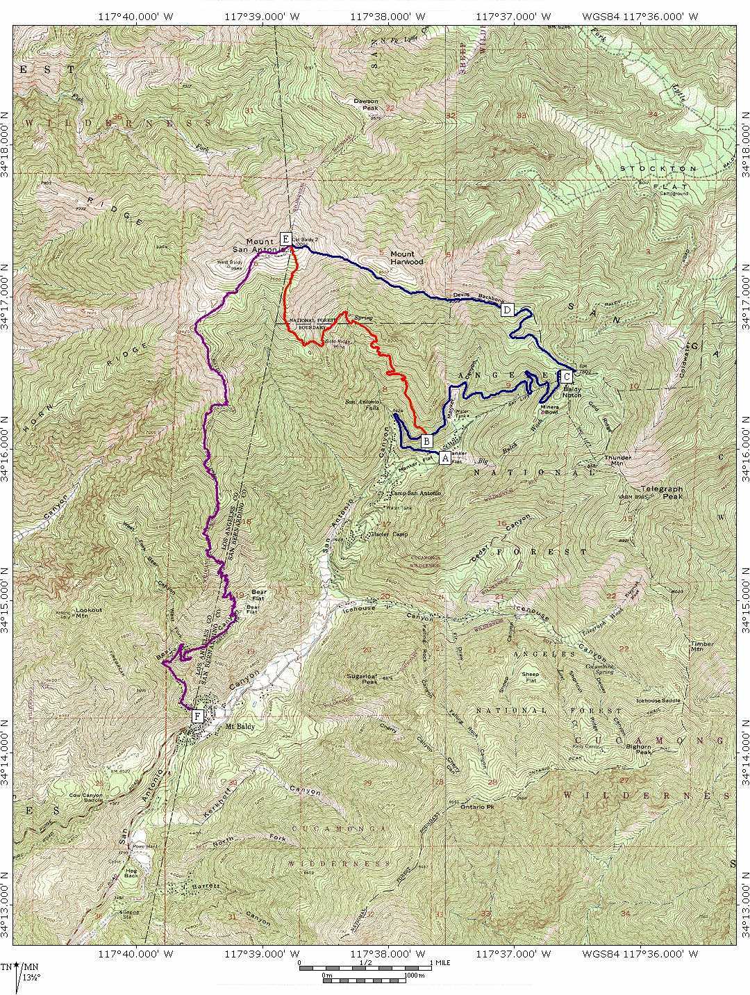
| To the Summit - from Mt Baldy Village - Via Bear Canyon Trail Purple trail F to E - Mt Baldy Village via Bear Canyon Trail to Summit This is a strenuous climb to the Summit - it is long , and on the edge of the wilderness area. This trail has really great views. I have seen Big horn sheep many times on this trail. Be prepared, this is a long hike, up or down, - take plenty of water, and the 10 essentials for wildernes hiking (see details) 4260' to 10,064' 5,804' vertical 6.3 miles = 921' per mile Topo w/details |
To the Summit - Via Baldy Bowl Blue trail A to B = .91miles and Red trail B to E = 3.20 miles San Antonio Falls, Sierra club, Baldy Bowl, and ridge to the summit This is a strenuous climb to the Summit, but the shortest F6F Hellcat wreckage can be viewed and accessed from this trail. 6156' to 10,064' 3,908' vertical 4.11 miles = 951' per mile Topo w/details - Click here for a Interactive Map
with links to pictures of features on map!!
|
To the Summit - Via Ski Lifts Blue trail A to E - falls Rd via Baldy Notch, Devils Backbone to Summit This is the easiest way to the summit You can by-pass 3.17mi. & 1600' by riding the ski lifts to the Notch. 6156' to 10,064' 3,908' vertical 6.2 miles = 630' per mile Topo w/details |